Read the Landscape, Not Just the Color
A beautiful river is never only a ribbon of photogenic water. Its color reflects rock, sediment, depth, light, and weather, while its bends record the work of gravity across an entire watershed. Towns, farms, forests, deltas, and wildlife all depend on that moving system. The most rewarding river journey therefore pairs a memorable view with time to understand the valley around it. Choose legal overlooks, locally operated boats, marked trails, and seasons that suit both water conditions and community life. Whether the river runs turquoise through an alpine gorge or brown with fertile silt across a floodplain, its beauty becomes richer when you see the living landscape rather than chasing a single perfect photograph.
A: Color varies with geology sediment light depth and recent weather.
A: Conditions differ but local operators can explain seasonal snowmelt and rainfall.
A: Smaller routes and shoulder dates can feel quieter.
A: Only on suitable sections with current local guidance and proper equipment.
A: Beauty does not reveal current temperature depth or contamination.
A: Some parks and reserves use permits parking limits or timed entry.
A: Only where legal and unlikely to disturb people or wildlife.
A: Hydrology ecology community history access and present conditions.
A: Usually a focused region creates a deeper and less rushed visit.
A: Spend locally follow access rules and support watershed conservation.
Soča River, Slovenia
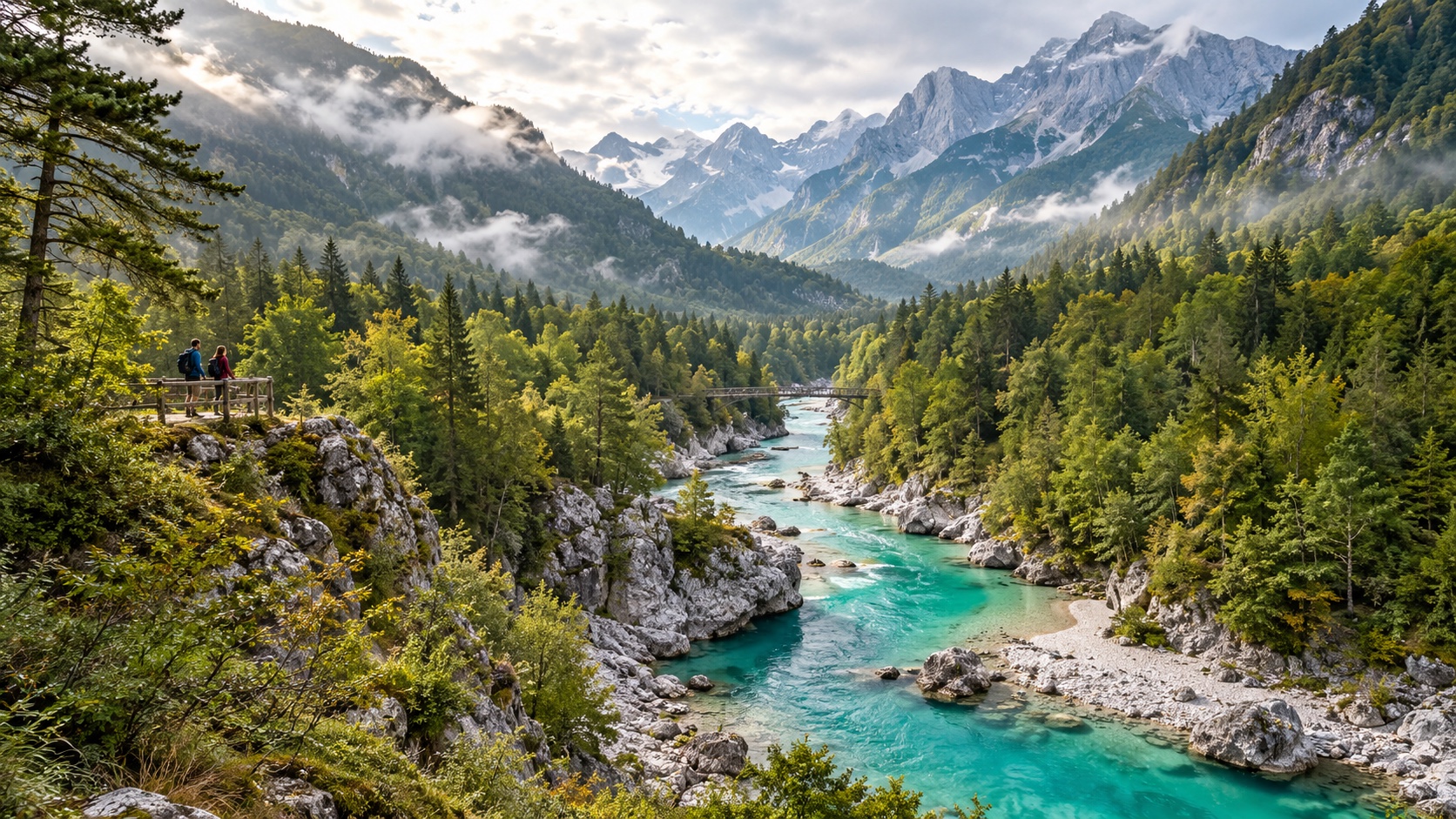
The Soča descends from the Julian Alps through a valley of limestone peaks, wooded slopes, suspension bridges, and pale gravel bars. Fine mineral particles and the character of the riverbed can make the water appear emerald or turquoise, particularly in softer light. The upper valley offers marked walks and road-accessible viewpoints, so dramatic scenery does not require stepping onto unstable banks.
The river is also known for paddling and angling, but conditions range from gentle reaches to technical white water. Book an appropriately licensed local operator and be honest about experience. Spring snowmelt, summer demand, and autumn weather create different journeys. Bovec and nearby villages make practical bases, while public buses or a compact itinerary can reduce repeated driving through the narrow valley.
Li River, China
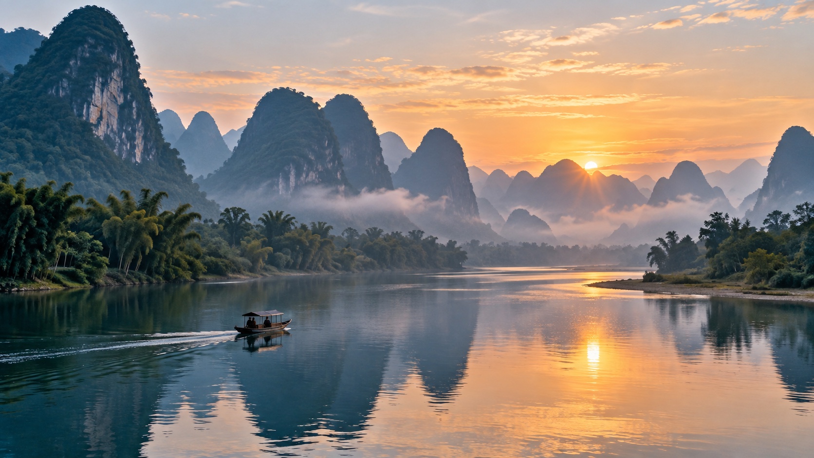
Between Guilin and Yangshuo, the Li moves through a celebrated landscape of steep karst towers, bamboo-lined banks, farms, and villages. Mist can simplify the peaks into layered silhouettes, while clear mornings reveal their textured limestone faces. A cruise gives the broad composition; a legal riverside path or bicycle route reveals smaller details such as fields, water buffalo, and working boats. Conditions and visibility change quickly, so do not treat haze as a failed day. It often creates the atmosphere for which this reach is known. Choose authorized transport, avoid crowding residents’ lanes, and spend time in established towns rather than using the valley merely as a moving backdrop.
Douro River, Portugal
The Douro enters Portugal through rocky country, then curves among terraced vineyards before reaching Porto and the Atlantic. Its beauty comes from the relationship between water and human labor: stone walls contour the hills, villages occupy limited shelves, and vines change color through the seasons. Train windows, public viewpoints, and modest river vessels each frame that geometry differently.
Base a visit in one or two towns instead of racing among estates. Winery appointments help manage traffic on narrow roads, and rail travel lets everyone watch the valley. Summer can be extremely hot, while harvest brings activity and demand.
Landscape does not erase working conditions or water pressures. Ask producers about land stewardship, respect active farms, and never enter terraces without permission. A slow itinerary gives room for local meals, museums, and walks beyond the most photographed bends.
Upper Amazon, Peru and Brazil
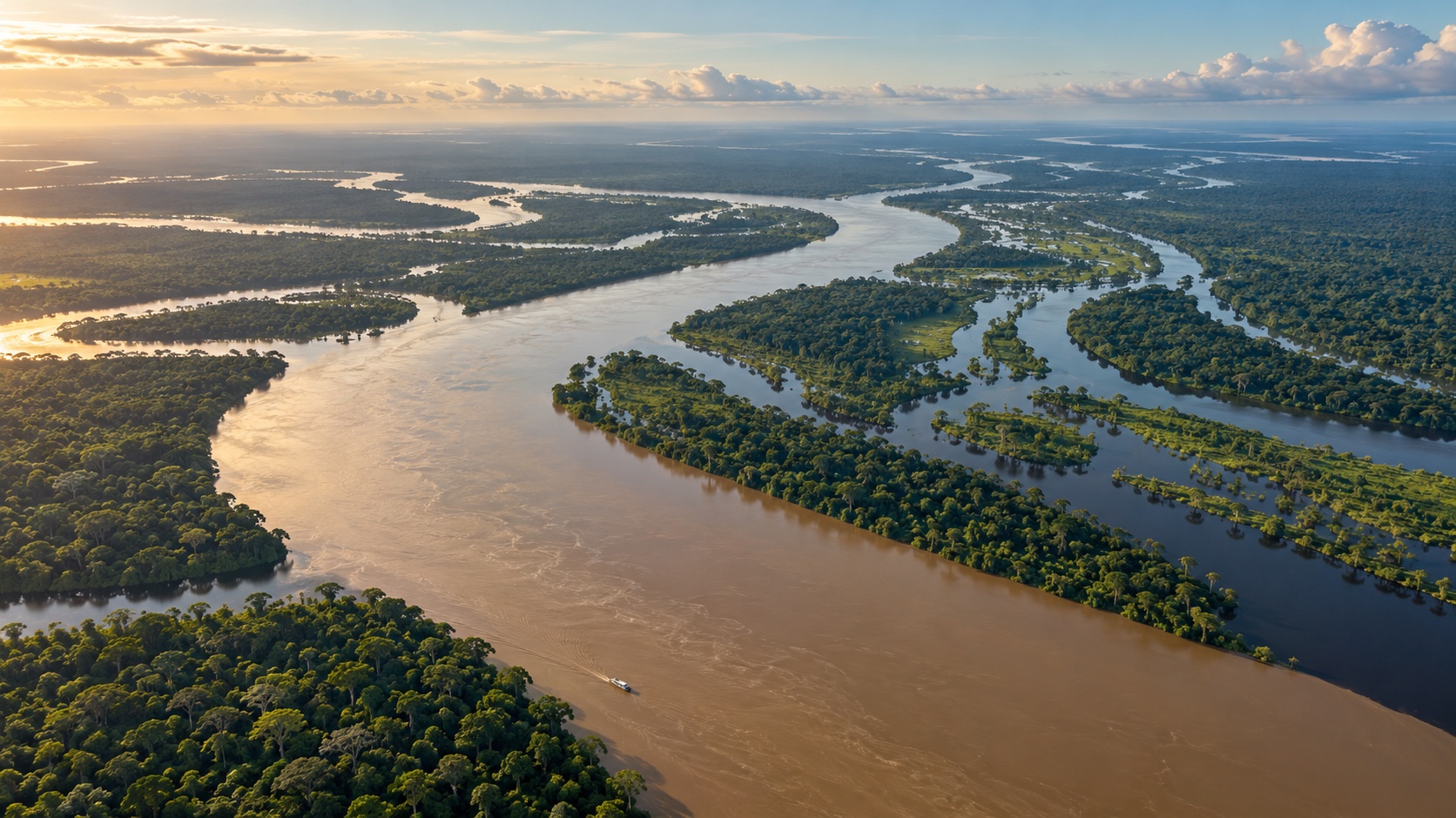
The Amazon is visually powerful because water, forest, sky, and seasonal floodplain merge at an immense scale. Near Iquitos or Manaus, travelers may see broad sediment-rich channels, dark tributaries, flooded forest, floating vegetation, and communities whose lives follow changing water levels. The river is not one pristine wilderness scene; it is a vast inhabited system with ports, fisheries, protected areas, and serious environmental pressures.
Select a lodge or vessel with transparent wildlife practices, trained naturalists, safe boats, and clear community relationships. Animals should be observed without baiting, touching, or staged captivity. Rain, heat, insects, and long transfers are part of the experience. Pack lightly, follow health advice from qualified sources, and let guides determine when conditions make a landing unsafe. The most memorable moments are often quiet: reflected canopy in a narrow channel, distant birds at dawn, or the meeting of waters with different sediment and chemistry. Stay several nights in one region so observation replaces checklist tourism.
Zambezi River, Zambia and Zimbabwe
Above Victoria Falls, the Zambezi spreads around islands and wooded banks; at the falls, it plunges into a basalt gorge with immense spray during higher flows. Water level transforms every viewpoint. A high-flow visit emphasizes thunder and mist, while lower water can reveal more rock and sectional detail. Neither is the single correct version, and conditions differ across the wide curtain. Use official park paths and respect barriers, since wet stone and cliff edges are unforgiving. Boat trips upstream may combine sunset light with wildlife observation, but operators should keep appropriate distances and never use animals as props. Border requirements, park fees, and access between the Zambian and Zimbabwean sides can change, so check official information. Build enough time to walk rather than reducing the river to a brief overlook.
Colorado River, United States
The Colorado’s most famous scenery lies within the layered rock of the Grand Canyon, yet its story spans alpine headwaters, reservoirs, desert canyons, farms, cities, and a diminished delta. From established rims, the river may look like a thin green line far below. At water level, walls rise in shifting bands of limestone, sandstone, and shale, revealing distance that a photograph compresses.
Multi-day canyon rafting is regulated and logistically demanding; commercial trips and permit systems require advance planning. Shorter overlooks and riverside sections provide alternatives for different budgets and abilities. Heat, flash floods, cold water, and remote terrain deserve conservative decisions. Carry appropriate supplies and follow park guidance. The river is also central to difficult regional questions about allocation and drought, so interpretive programs add essential context. Beauty here is inseparable from scarcity and shared dependence.
Mekong River, Southeast Asia
The Mekong connects uplands, cities, farms, fisheries, wetlands, and a vast delta across several countries. Its appearance shifts from rocky northern reaches to broad lowland channels and braided distributaries. Markets, ferries, temples, orchards, and riverside homes show a waterway supporting daily life rather than a landscape set aside for visitors.
Choose one region and learn its seasonal rhythm. High water, dry-season sandbars, navigation conditions, and agricultural calendars affect what can be seen. Locally run day boats and homestays can distribute spending, but privacy and genuine consent still matter.
Large vessels create wake, small craft require proper flotation gear, and remote landings may be uneven. Hydropower, sediment change, and fisheries pressures are part of the contemporary story. Responsible guides should discuss them without turning residents into exhibits. Eat locally harvested food only when legal and sustainable, and avoid wildlife products.
Nile River, Egypt
In Egypt, the Nile forms a fertile corridor through desert, concentrating fields, towns, archaeological sites, and palms beside a moving band of water. The contrast is clearest from a small sailing boat, a riverside train, or a viewpoint away from midday glare. Around Luxor and Aswan, the river provides both visual calm and a route through layers of history. A felucca trip can be atmospheric, but confirm the itinerary, safety equipment, sanitation, price, and overnight arrangements. Larger cruises offer comfort yet vary greatly in environmental practice and local economic benefit. Combine monuments with present-day context, use qualified guides, dress respectfully in communities, and ask before photographing people. Early mornings and late afternoons provide gentler temperatures, while winter is generally busier. The river is living infrastructure, not simply a backdrop to antiquity.
Rhine River, Germany and the Netherlands
The Rhine combines steep vineyard slopes, castles, industrial ports, restored river edges, and low-country distributaries. In the Upper Middle Rhine Valley, trains run close to the water and boats pass villages beneath ridges, making car-free exploration unusually practical. Castle silhouettes are compelling, but the working channel—with barges, signals, and engineered banks—explains why the river shaped European trade.
Use regional rail and walking routes to experience separate bends rather than staying onboard all day.
Farther downstream, Dutch branches enter a managed delta of dikes, floodplains, wetlands, and cities. Cycling paths can reveal how communities live with water, though strong winds and busy crossings require preparation. Respect signed habitat closures. The Rhine’s beauty lies partly in the negotiation between navigation, settlement, flood protection, and ecological restoration.
Danube Delta, Romania
Before reaching the Black Sea, the Danube divides into channels, lakes, reedbeds, sandbars, and maritime forest. The horizon becomes low and expansive, with changing patterns of water and vegetation rather than a single monumental landmark. Birds are a major attraction, but responsible viewing demands distance, quiet, and sensitivity during nesting periods.
Travel with an authorized local boat operator who follows speed limits and established routes. Fast approaches create wake and disturb narrow channels. Smaller groups can listen and observe more carefully. Villages within the delta have distinct cultures and practical constraints. Use locally owned lodging where possible, manage waste, conserve water, and ask before photographing homes or fishing work. Mosquitoes, sun, wind, and sudden weather require preparation. A two- or three-night stay allows the delta’s subtle changes to emerge.
Franklin River, Tasmania
Tasmania’s Franklin flows through rugged southwest wilderness of rainforest, quartzite gorges, tannin-dark water, and remote valleys. It became internationally associated with the campaign that stopped a proposed dam, giving the scenery a powerful conservation history. There are viewpoints and walks for independent visitors, while a full rafting descent is a serious expedition rather than a casual outing.
Remote rafting requires experienced leadership, cold-water equipment, rescue planning, and flexibility for changing levels. Portages and camps must follow current management rules.
Travelers who stay on land can still understand the river through protected-area interpretation, shorter trails, and regional museums. Weather may obscure distant views or saturate the forest, but rain is fundamental to the ecosystem. Clean footwear and gear where requested to reduce the spread of disease and invasive organisms.
Choose One Reach and Travel Deeply
The best river trip is not the itinerary with the most famous names. It is the one that matches season, ability, time, and curiosity. Begin with a particular reach: an alpine gorge, vineyard valley, desert canyon, floodplain, or delta. Check official access and weather information, then choose a local base that supports several ways of seeing the water. Mix a guided experience with independent time. A boat may explain navigation and ecology, while a train, bicycle, or marked walk reveals settlements and tributaries. Leave unscheduled hours for changing light or weather. Finally, remember that every viewpoint belongs to a watershed. Use refillable bottles where water is safely available, avoid bank erosion, keep distance from wildlife, and support credible conservation groups. Seeing a river beautifully means recognizing the lives and landscapes carried within its flow. Before confirming reservations, examine the full route on a watershed map. The tributaries above a viewpoint, the farms and towns beside it, and the wetlands below it explain why conditions change. Read one locally produced history, learn who manages access, and identify a community business you can support. If rain, smoke, drought, or a closure changes the trip, respond with patience instead of seeking an unauthorized substitute. A river does not owe visitors a particular color or water level. The ability to adapt is part of traveling beside a dynamic system, and it protects both people and place. That perspective lasts beyond the photograph.