A River Is a Living System Rather Than a Scenic Backdrop
Rivers connect mountains, forests, farms, wetlands, cities, wildlife, and communities. Their beauty changes with season, water level, weather, light, dams, floods, drought, and the ways people live along their banks. Travelers can experience them by foot, train, small boat, ferry, paddle craft, viewpoint, or community-led tour without treating the waterway as an amusement corridor. Before booking, examine safety, current access, boat standards, wildlife distance, wastewater, group size, local ownership, and whether an activity interferes with fishing, transport, or sacred places. The rivers below offer remarkable scenery, but conditions and regulations change. Use official sources, choose trained operators, wear appropriate flotation equipment, and let the river determine when a plan should change.
A: No trains trails ferries viewpoints and community tours may offer richer access.
A: No safety fuel waste ownership and wildlife conduct still matter.
A: Only where authorities confirm currents water quality and access are safe.
A: It depends on navigation scenery heat wildlife and regional climate.
A: Yes on suitable sheltered water with instruction and rescue support.
A: They change ecosystems and scenery but also belong in the river’s human story.
A: Hire resident guides and use locally owned lodging food and transport.
A: No wild behavior and changing habitat prevent honest guarantees.
A: Appropriate flotation sun weather and communication gear for the activity.
A: Safe travel that respects the waterway and those who depend on it.
Li River China
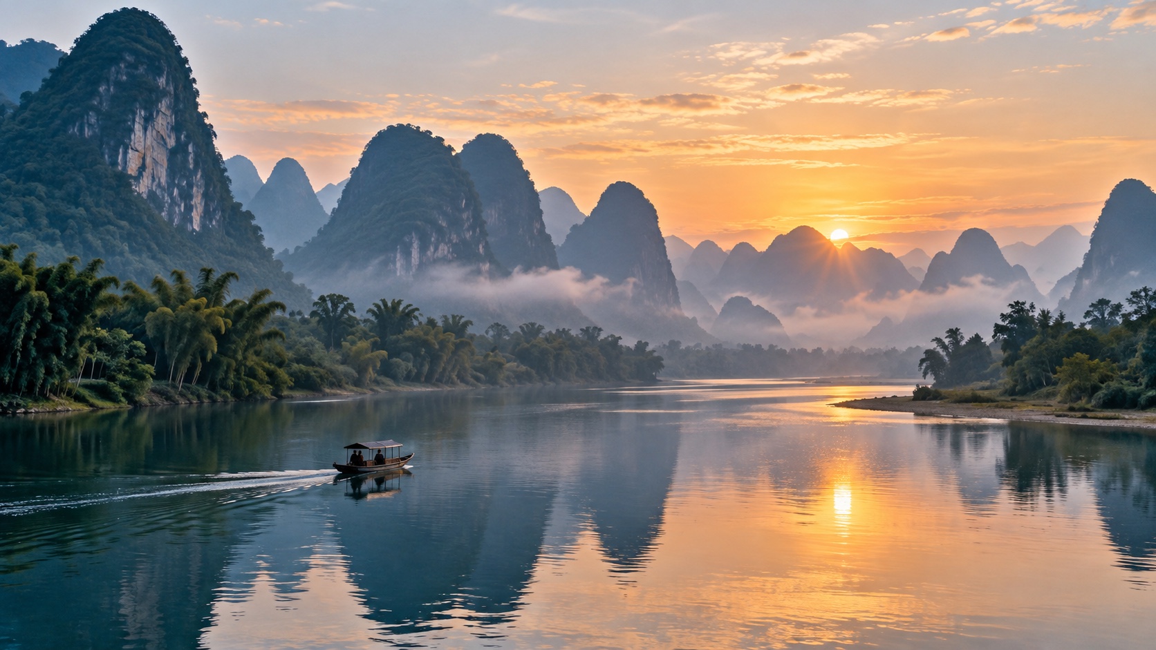
The Li River between Guilin and Yangshuo winds through limestone karst towers, bamboo groves, farms, and villages. Mist and changing light make the scenery especially atmospheric, while cruises, smaller boats, bicycles, and riverside walks offer different perspectives. Popular sections can become crowded, so departure time and route choice matter. Choose licensed transport, follow current navigation rules, and avoid staged wildlife or fishing performances. Smaller craft should still provide life jackets and clear safety procedures. Stay several nights in the region rather than treating the river as a single transfer. Paths and village roads require respect for farms, homes, and ordinary traffic. Water color varies with weather, sediment, sun, and season, so travelers should not expect a brochure shade every day. Early and late light can improve views without entering private fields. Cycling between communities is possible on selected roads and paths, but traffic and surface conditions require route planning. A resident guide can connect karst geology, farming, flood history, and river management.
Soča River Slovenia
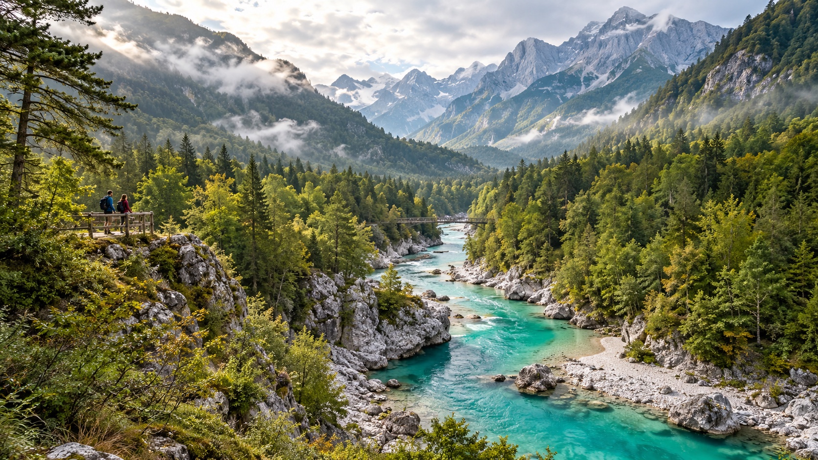
The Soča flows through alpine valleys in western Slovenia with striking blue-green water, forests, gorges, footbridges, and mountain views. Travelers can hike beside calmer sections, visit established viewpoints, or join rafting and paddling trips. Water temperature and current remain serious even when the color looks inviting.
Use qualified operators, fitted flotation equipment, helmets where required, and routes suited to actual experience. Snowmelt and rain can change difficulty quickly.
Stay on durable trails, avoid trampling riverbanks, and keep clear of anglers and nesting areas. Buses and regional bases can reduce parking pressure at narrow access points.
Douro River Portugal
The Douro moves through steep terraced vineyard landscapes before reaching Porto and the Atlantic. Rail journeys, riverboats, roads, and walking routes each reveal the relationship between water, geology, agriculture, villages, and wine production. Heat and limited shade make the timing of summer outings important. Compare day boats with ordinary trains and locally based tours rather than assuming a cruise is necessary. Ask about vessel capacity, fuel, wastewater, and shore time. Vineyard visits should explain labor, water, and land practices without reducing the valley to tastings. Staying in a smaller town spreads spending and gives the river a quieter evening presence. Locks, dams, and engineered banks shape the modern Douro. Learning how navigation and hydropower changed the valley adds substance to the scenery. Rail service can also reveal the river at a human scale, with stops for walking or locally owned lodging. Visitors should keep station platforms, village lanes, and vineyard work roads clear rather than treating every foreground as a photo set.
Upper Amazon and Its Tributaries
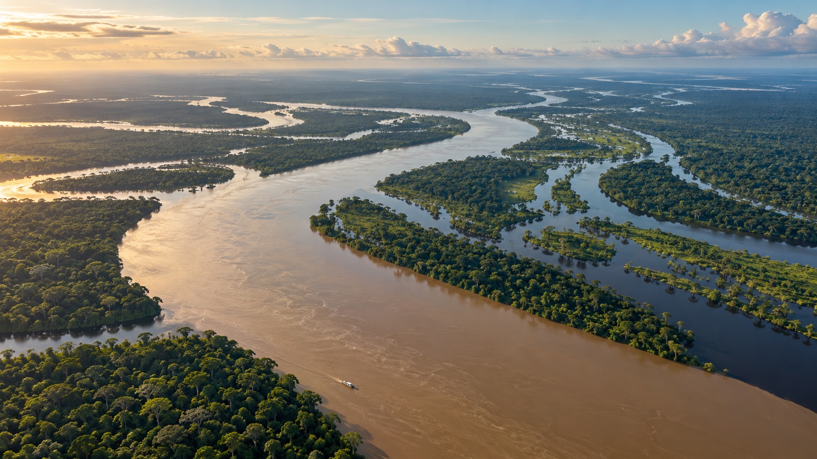
The Amazon system is too vast for one experience. In Peru, Ecuador, Brazil, Colombia, and other countries, tributaries pass through floodplain forest, blackwater, wetlands, cities, Indigenous territories, and protected areas. Water levels shape boat access, wildlife distribution, trails, insects, and the appearance of the forest.
Choose locally rooted operators with safe boats, trained guides, clear land permissions, responsible wastewater systems, and explicit wildlife rules. Avoid animal handling, baiting, and contact with isolated communities. A longer stay at one lodge or community enterprise produces more understanding than a rapid circuit. Heat, storms, smoke, disease risk, and remote medical care require preparation.
Mekong River Southeast Asia
The Mekong connects highlands, cities, farms, fisheries, wetlands, islands, and the delta across several countries. Ferries, longboats, riverside cycling, markets, and wetland tours can reveal daily life, while dams and changing water patterns show that the river is also an economic and political system.
Use licensed boats with flotation equipment and avoid tours that intrude on homes or stage poverty. Markets are workplaces, not sets. Travel slowly through one region instead of collecting border crossings. In dolphin habitat and other sensitive areas, follow speed and distance rules. Seasonal heat, monsoon, air quality, and navigation conditions should guide timing.
Homestays and community visits require clear host control, fair payment, and genuine consent. A boat arriving with cameras should never turn a working village into an exhibit. Ask who designed the visit and whether residents can decline. River dolphins, birds, and other wildlife should be observed at distance without feeding or pursuit. Quiet travel protects both habitat and the dignity of river communities.
Nile River Egypt
The Nile corridor joins agricultural landscapes, desert edges, cities, temples, islands, and long histories of settlement. Traditional-style sailing, ferries, trains, and larger vessels create different experiences. A slower journey around Aswan or between selected historic sites can reveal the river beyond a tightly scheduled cruise.
Confirm vessel licensing, life jackets, shade, toilets, and crew conditions. Cultural sites need authorized guides and respect for photography rules. Avoid treating riverbank residents as scenery. Heat can be extreme, making early outings, hydration, sun protection, and realistic pacing important. Learn how dams, irrigation, and water use shape the modern river as well as its ancient associations.
Colorado River United States and Mexico
The Colorado passes through alpine headwaters, desert canyons, reservoirs, farms, cities, and the border region. Grand Canyon rafting is famous, but riverside trails, overlooks, educational centers, and upper-river trips offer additional access. Water allocation, dams, drought, and ecosystem restoration are inseparable from the scenery. Commercial canyon trips require permits, trained guides, rigorous waste systems, fitted flotation equipment, and heat preparation. Private trips demand extensive experience and planning. Never underestimate cold water or powerful current because the air is hot. At viewpoints, stay behind barriers and avoid unmarked shortcuts that damage desert soil.
Zambezi River Zambia and Zimbabwe
The Zambezi creates wetlands, broad channels, wildlife habitat, gorges, and Victoria Falls before continuing toward the Indian Ocean. Viewpoints, river cruises, canoe trips, and rafting vary enormously in risk and ecological pressure. Water level changes both the appearance of the falls and which activities are possible.
Use licensed operators with strong safety systems, appropriate group ratios, and clear wildlife protocols. Hippos, crocodiles, current, heat, and remote access make unguided paddling inappropriate in many places. Keep distance from animals and never pressure a guide for a closer approach. Locally owned lodging and guides can broaden community benefit.
The Zambezi’s border setting around Victoria Falls means travelers may cross between Zambia and Zimbabwe. Verify visas, park fees, opening hours, health guidance, and transport rather than relying on an old package description. Spray can drench paths at high flow and reduce visibility, while heat can be severe later. Stay behind barriers, use footwear with grip, and protect equipment from water.
Rhine Gorge Germany
The Upper Middle Rhine Valley combines a working river with steep vineyards, castles, towns, railways, ferries, and long-distance paths. Scheduled boats and trains make it possible to experience the gorge without a car. Freight traffic is part of the river’s present-day character rather than an interruption to a romantic landscape.
Use one or two town bases and connect walks with public transport. Vineyard paths can be steep and exposed to sun, while castle hours and ferry schedules change seasonally. Keep away from rail lines and working docks. Independent restaurants, guesthouses, and wineries spread spending beyond crowded day-trip stops.
Danube Delta Romania
The Danube Delta forms a complex wetland of channels, lakes, reed beds, villages, fish, and migratory birds before meeting the Black Sea. Small-boat tours can reach quiet habitat, but speed, noise, wake, and route choice influence wildlife and banks. Resident guides bring essential knowledge of changing channels and seasons. Choose legal accommodation and licensed boats, ask about group size and engine practices, and avoid playback or close approaches near nesting birds. Mosquitoes, heat, storms, and limited medical access require preparation. The delta is also home, so keep village docks clear and respect fishing activity, private property, and local food traditions. Birding is strongest when groups remain small and guides limit playback, speed, and approach. Exact nesting sites should not be shared publicly. Boats passing through reed channels create wake that affects banks, so captains should operate conservatively. Visitors can support the delta by staying longer with legal local providers and eating regional food rather than arriving only for a brief wildlife checklist.
Franklin River Tasmania Australia
Tasmania’s Franklin flows through remote temperate wilderness with rainforest, gorges, rapids, and a powerful conservation history. Multi-day rafting is a serious expedition requiring expert leadership, cold-water equipment, technical skill, food and waste systems, and emergency plans. It is not a casual scenic float.
Travelers can also learn about the river through lower-risk walks, viewpoints, museums, and guided interpretation. Weather and water levels can change rapidly, while remote rescue is difficult. Choose operators that respect protected-area rules and Aboriginal heritage. Every item must be carried and managed without contaminating the river. River safety extends to shore. Wet stone, unstable banks, flash floods, steep access paths, heat, insects, and contaminated water can affect travelers who never board a boat. Wear suitable footwear, keep children close, and obey barriers. Do not walk onto exposed sandbars or rocks without understanding releases and rising-water risk. A tranquil photograph may conceal powerful hydrology. Photography from a moving vessel requires discipline. Keep aisles, railings, and the captain’s sightlines clear, secure equipment, and remain seated when instructed. Telephoto lenses reduce pressure to approach wildlife or shore activity. Drones may be illegal, unsafe near aircraft or birds, and intrusive around homes; leave them grounded unless explicit authorization covers the exact place and flight. Accessibility should be verified in detail. Dock ramps, water-level changes, narrow gangways, fixed seating, toilets, heat, vibration, and emergency evacuation may create barriers not mentioned by a general accessible label. Ask the operator for measurements and boarding procedures. Shore-based viewpoints, trains, promenades, and ferries may offer stronger alternatives without reducing the importance of the river experience. Food and drink aboard a boat create waste that the operator must store and dispose of properly. Bring reusable containers only when cleaning and local water systems make them practical, and never throw biodegradable scraps overboard. Ask how sewage is managed. A vessel that keeps its wake small but releases waste is not operating responsibly.
Follow the River at a Responsible Pace
A river journey should leave time to watch changing banks, light, work, wildlife, and settlement. Select one region, use local guides, and compare boats with rail, walking, cycling, or ferry access. Verify safety equipment, permits, wastewater, group size, and the operator’s relationship with river communities.
Check weather upstream as well as locally, respect closures, and keep a land-based backup.
Do not swim, paddle, or approach wildlife because a photograph makes the water appear calm. Rivers are beautiful precisely because they move through many lives and landscapes; the visitor’s role is to travel lightly within that flow.