A Lake Begins With a Basin and a Water Balance
Every lake needs a depression that can hold water, but the process that creates that basin may take seconds, centuries, or millions of years. Ice can scour rock, faults can pull crust apart, eruptions can leave craters, rivers can abandon bends, and barriers can dam valleys. Rain, snowmelt, streams, groundwater, evaporation, and outlets then determine whether water remains and how its level changes. Appearance comes later: depth, bottom material, suspended sediment, dissolved substances, algae, surrounding vegetation, sky, and viewing angle all influence what we see. Understanding those ingredients turns a lake from a pretty surface into evidence of a landscape still changing. The examples below explain common origins without implying that every lake fits only one category.
A: No impacts sinkholes ice and other processes can make rounded basins.
A: Yes later erosion dams or sediment can modify an older basin.
A: Closed basins can retain dissolved minerals as water evaporates.
A: Fine sediment depth and light can combine but conditions vary.
A: No clarity alone cannot measure contaminants or ecological condition.
A: A river cuts through a meander and leaves the former bend isolated.
A: Some are geothermally influenced while many are not.
A: They are shallow waters separated from larger water bodies by barriers.
A: Yes outlets erosion evaporation vegetation and sediment can transform them.
A: They are lake-like water bodies created or enlarged by human barriers.
Glaciers Carve and Dam Lake Basins
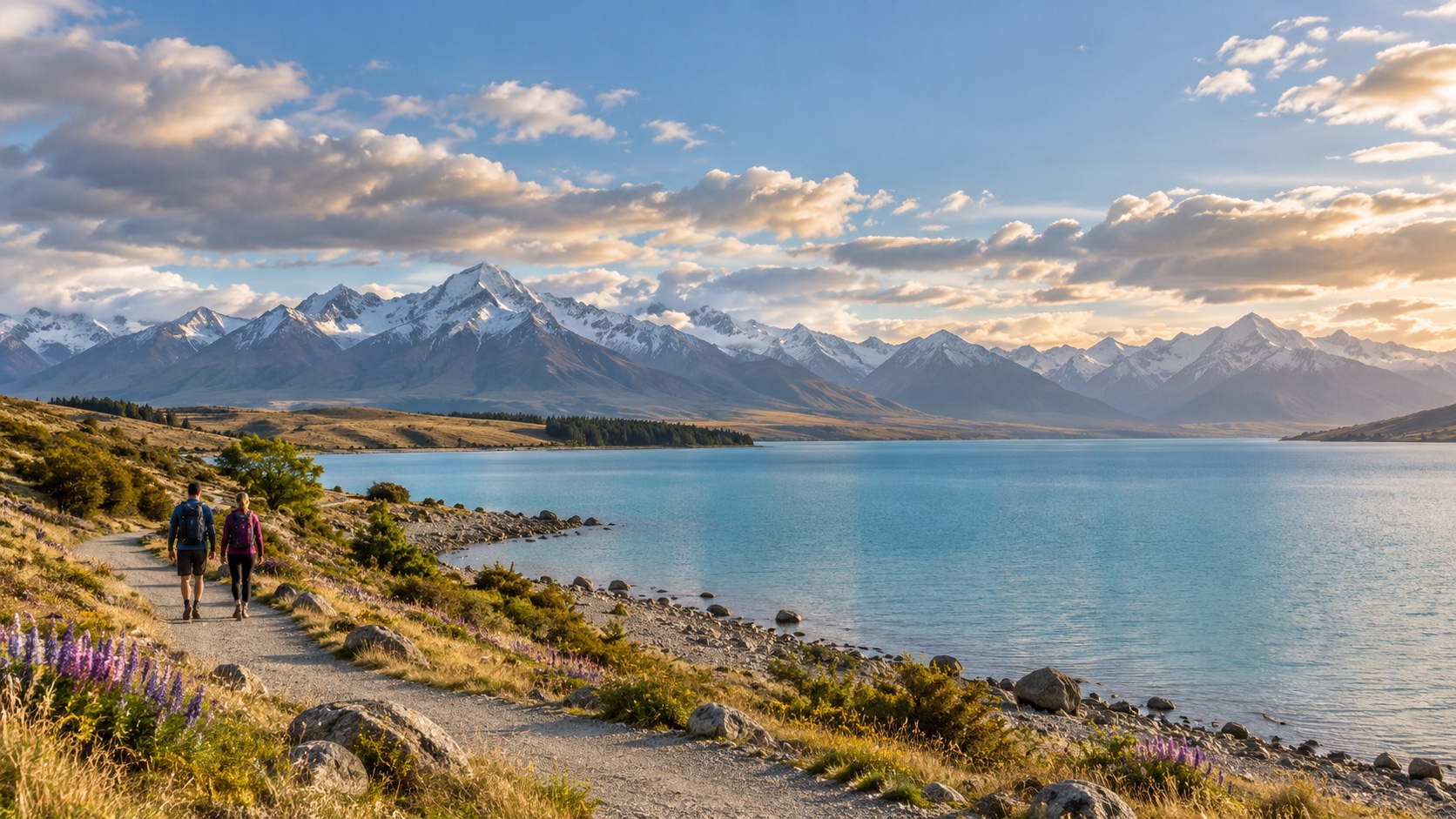
Moving ice reshapes terrain by plucking rock, grinding valley floors, and deepening existing depressions. When a glacier retreats, water can occupy the scoured basin. Long narrow lakes may fill overdeepened valleys, while small tarns sit in bowl-like cirques high in mountains. The Great Lakes of North America occupy much older geological depressions that continental ice further excavated and modified.
Ice also transports enormous quantities of debris. Ridges of this material, called moraines, can act as natural dams after retreat. Smaller blocks of buried ice may melt within glacial sediment and leave kettle holes that fill with water.
Many basins combine several glacial effects, so a simple label hides a complex history. Visitors can look for U-shaped valleys, polished bedrock, moraines, outwash plains, and chains of lakes. Never approach unstable ice or freshly exposed slopes without current guidance.
Tectonic Forces Pull Basins Apart
Earth’s crust moves along faults and plate boundaries. Where blocks drop or the crust stretches, long deep depressions can form and later collect water. Lake Baikal and lakes of the East African Rift occupy tectonically active regions, explaining their elongated shapes, exceptional depths, and steep margins. Lake Tahoe also lies within a fault-bounded basin modified by other processes.
These lakes may persist for very long periods, allowing distinctive ecosystems to evolve, but old does not mean unchanging. Earthquakes, uplift, subsidence, sediment, climate, and changing outlets continue to reshape them. Travelers should use designated viewpoints and follow local hazard information. A panoramic shoreline can be read as the surface expression of structures extending deep into the crust.
Volcanoes Leave Craters, Calderas, and Lava Dams
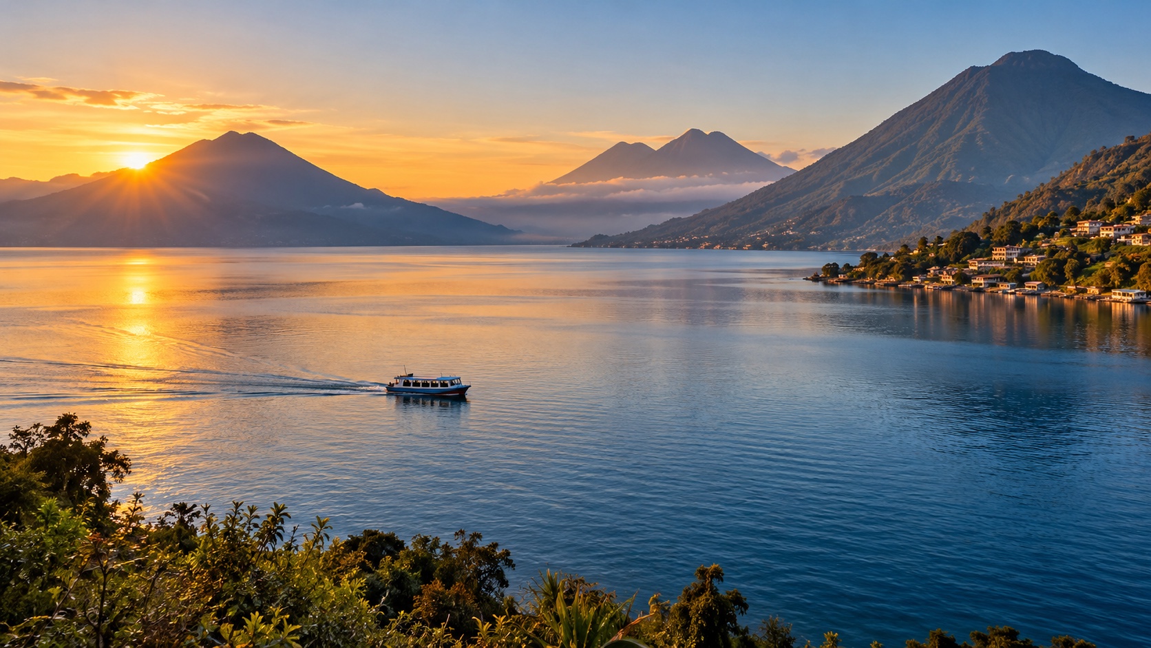
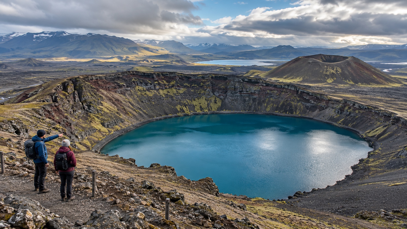
Volcanic activity creates lakes in several ways. Water may fill a crater around a vent, or occupy a much larger caldera left when the ground collapses after a major eruption empties part of a magma reservoir. Crater Lake in Oregon and Lake Toba in Indonesia illustrate dramatically different scales. Lava flows can also block valleys and redirect drainage, forming lakes behind natural barriers. Rounded shape alone does not prove volcanic origin, and not every crater lake is hot or acidic. Chemistry depends on rock, groundwater, gases, rainfall, and ongoing geothermal activity. Stay on marked routes around rims, which may be steep, unstable, windy, or affected by hazardous gases.
Rivers Cut Off Their Own Bends
On low-gradient floodplains, a river often migrates sideways in looping meanders. Water erodes the outside of bends and deposits sediment on the inside, narrowing the neck between adjacent curves. During a flood or gradual channel shift, the river may cut a shorter path across that neck.
Sediment then seals the ends of the abandoned bend, creating a curved oxbow lake. With limited flow, it gradually fills with fine sediment and organic matter.
Oxbows are productive wetland habitats and records of former channels. They may eventually become marsh or forest, demonstrating that “lake” is a stage rather than a permanent endpoint. Observe from firm public ground because floodplain banks can be muddy, undercut, and privately owned.
Landslides Create Sudden Natural Dams
Rockfalls, debris flows, earthquakes, or unstable slopes can send material across a valley and block a river with little warning. Water rises behind the obstruction to form a landslide-dammed lake. Some survive for centuries; others drain catastrophically when water overtops or cuts through loose debris. Lake Sarez in Tajikistan formed after a massive earthquake-triggered landslide in 1911, while many smaller examples appear after storms and earthquakes. These basins are reminders that a calm surface can conceal continuing hazard. Access may be restricted for monitoring or evacuation planning. Never climb a dam or approach a newly formed lake without authorization, and rely on geological agencies rather than social-media speculation about stability.
Karst and Sinkholes Dissolve Soluble Rock
Rainwater becomes slightly acidic as it absorbs carbon dioxide from air and soil. Over time it can dissolve limestone and other soluble rock, enlarging fractures, caves, and underground drainage. When the surface subsides or collapses, the resulting sinkhole may hold water if its bottom becomes sealed or intersects groundwater.
Karst lakes range from small circular ponds to larger fields of connected basins. Croatia’s Plitvice landscape also shows how carbonate deposition can build natural barriers between lakes, so dissolution and precipitation may both shape a system. Water levels can change rapidly through underground passages. Remain on boardwalks and marked paths: thin soil, hidden cavities, and delicate mineral formations make shortcuts unsafe and damaging.
Coastal Barriers Enclose Lagoons
Waves and currents move sand and gravel along coasts, building spits, barrier islands, or bars. When these features partly or fully separate shallow water from the ocean, they create a lagoon. Inlets may open, migrate, or close, while storms can breach barriers and rapidly change salinity.
Some coastal lagoons are brackish because fresh and salt water mix; others become fresher or saltier depending on rainfall, evaporation, groundwater, and ocean exchange.
Lagoons support nurseries, wetlands, fisheries, and bird habitat, yet they are vulnerable to pollution and development. Use public access and avoid dunes or nesting areas. Their apparent stillness exists because an active coastal barrier absorbs wave energy and constantly shifts.
Meteorite Impacts Excavate Circular Depressions
When a large extraterrestrial object strikes Earth, the immense energy can excavate a crater, fracture underlying rock, and raise a rim. If climate and geology permit, water later collects in the depression. Lonar Lake in India occupies an impact crater in basalt, while other old impact structures contain lakes or have been altered beyond easy recognition.
A circular shoreline is only a clue. Scientists confirm impacts using shocked minerals, unusual rock structures, geophysics, and other evidence. Volcanism, sinkholes, and glacial processes can also produce rounded basins. Visitors should use geological interpretation and protected trails instead of removing rocks. Even a small specimen may be scientifically valuable or legally protected.
Wind, Permafrost, and Floodplains Add More Origins
In dry regions, wind can remove loose sediment and create deflation hollows that occasionally hold water. On cold landscapes, ground ice can melt and cause the surface to subside, forming thermokarst lakes. Their expansion or drainage can be rapid as permafrost changes.
Floodplains contain many other basins besides classic oxbows. Abandoned channels, levee depressions, and seasonal floodwater can produce shallow lakes whose boundaries move from year to year.
These water bodies may be temporary yet ecologically important. A dry basin is not necessarily a failed lake; it may reflect the normal cycle. Avoid vehicle tracks on soft beds and follow seasonal closures, because disturbance can persist long after water returns.
Human-Built Dams Create Reservoirs
A dam interrupts a river and raises water over a valley, producing a reservoir used for drinking water, irrigation, hydropower, flood control, navigation, or recreation. Some projects enlarge a natural lake, while others submerge entire channels, settlements, farms, and habitats. Reservoirs often have branching shorelines that trace former tributary valleys, and their water levels may change rapidly with operations. They behave like lakes in many ways but retain a managed purpose and altered river flow. Safety zones around dams, spillways, and intake structures are mandatory. Learn whose land and cultural sites were affected, not only the engineering story.
Color and Clarity Have Multiple Causes
Pure water absorbs longer red wavelengths more readily than blue, but a real lake’s appearance depends on far more than water alone. Fine glacial rock flour can scatter blue or green light. Algae and other organisms may add green, brown, or red tones. Dissolved organic matter from soils and vegetation can make water tea-colored, while minerals, suspended sediment, depth, bottom material, clouds, and viewing angle all contribute.
A photograph taken after calm dry weather may look nothing like the same shore after a storm. Seasonal mixing and biological growth also alter clarity. Color is not a reliable safety test. Brilliant water can be cold, acidic, contaminated, or affected by harmful algal blooms, while dark natural water may be healthy. Follow current local monitoring before swimming or drinking.
Lakes Fill, Drain, Mix, and Evolve
Lakes are temporary features on geological timescales. Streams deliver sediment, plants accumulate organic matter, deltas advance, outlets erode, and climate changes the balance between inflow and evaporation. A basin may become shallower, turn into wetland, drain after a barrier fails, or expand behind a new obstruction. Deep lakes can also separate into temperature layers and mix seasonally, influencing oxygen and nutrient distribution. Human withdrawals, dams, land use, invasive species, and warming add new changes. Instead of asking only how a lake formed, ask what is happening now. Repeated photographs, water-level records, sediment cores, maps, and community knowledge help scientists reconstruct both past and present. Begin an interpretation with a topographic map. A circular rim may suggest a crater, a long straight shore can align with faults, a chain of basins may follow a glacial valley, and a crescent beside a river may preserve an old meander. Those are hypotheses, not verdicts. Rock types, sediment, fossils, landforms, geophysical measurements, and dated material allow scientists to test the story. Similar shapes can result from very different processes. Next, trace the water balance. Mark streams, springs, groundwater connections, rainfall, snowmelt, evaporation, and any surface outlet. A closed basin commonly concentrates dissolved minerals because water leaves mainly by evaporation, whereas a lake with a strong outlet exports some dissolved and suspended material. Levels may fluctuate naturally, but withdrawals and control structures can change the timing or magnitude. One dry shoreline does not by itself explain the cause. Look at the basin as a sequence rather than a frozen feature. A glacier may deepen a tectonic depression and leave a moraine across its end. A landslide can divide an older lake. A river delta may steadily fill one arm while waves rework another shore. People may later add a dam, diversion, road, or seawall. The most accurate origin story often uses several chapters. Visitors can investigate without collecting specimens or leaving trails. Read official interpretation, compare historical maps, observe from durable public surfaces, and ask a trained guide which evidence is visible. Leave rocks, fossils, plants, and monitoring equipment untouched. At volcanic, landslide, karst, and reservoir sites, barriers may mark hazards that are not obvious from the water’s calm appearance. Finally, separate appearance from condition. Clear blue water can be extremely nutrient-poor, cold, acidic, contaminated, or simply deep; green water may reflect natural productivity or a harmful bloom that requires testing. Odor, color, and clarity are observations, not laboratory results. Current environmental and public-health notices should determine swimming and drinking decisions. A scientifically curious visitor stays open to complexity, because every lake is both a record of how its basin formed and a present-day system responding to water, climate, organisms, and human choices.